

Mark3D
-
Posts
720 -
Joined
-
Last visited
Content Type
Profiles
Forums
Gallery
Posts posted by Mark3D
-
-
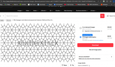
Here is a possible option, or if you could get a photo with your phone with even lighting no shadows and crop it so its tile able, this image shows as tile able.
-
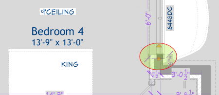
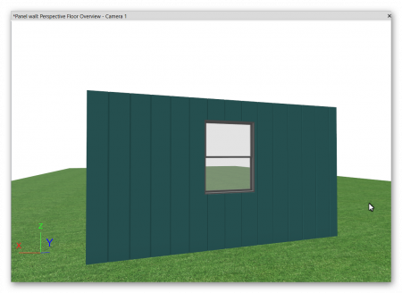
Here is a rough go at it i placed some cad to use as snap points when drawing walls
-
 1
1
-
-
On 2/8/2026 at 6:08 AM, robdyck said:
Here's the problem: the small room divider walls that separate the wall types at the window wells. Delete this and it works correctly. Of course, you'll need to figure out another method to control those walls.
Great job trouble shooting
-
1
-
-
I was thinking version 14 was the last on that we owned not sure on that though.
-
See if that works I turned off furred walls and turn room definition on I have notice furred walls giving trouble.
-
I can't help with your problem sorry i tried but no luck, but I had a thought when sharing file on chief talk for help I would export disconnected plan file it is way smaller
-
This forum is for chief architect not home designer
https://hometalk.chiefarchitect.com/
if you want share your file with home designer version as they are compatible with each other some should be able to guide you with your problems
-
 1
1
-
-
2 hours ago, DustinCourtright said:
It opens but says I’m only allowed to view. However I was easily able to do it myself from the YouTube video you made. Thanks again!
this was not selected
-
6 hours ago, DustinCourtright said:
@Mark3D That was extremely fun to watch and also very informative! My apologies for not thinking to share what version I'm using. The last Chief version I used was X14 but then that computer kicked the bucket one day and I couldn't find my key info so I actually went about 6 years without using Chief at all. Then I bought my current house and missed this as a hobby so I purchased the cheaper Home Designer Pro 2021 since I just use this as a hobby. I opened your plan and I can only view it and not actually modify it. But with the video I should be able to use that video to copy what you did into my plan. Just have to say I appreciate it more than you know. In today's world there's not a lot of people willing to selflessly help people out without expecting something in return. Thanks so much =)
You should be able to get x14 working as i think its the last version that we get to own, so contact chief and see if they can help you get working again
-
Version 12 should open in home designer 2021 not that you need it as the fix is not to hard
-
Video show fix
-
1
-
-
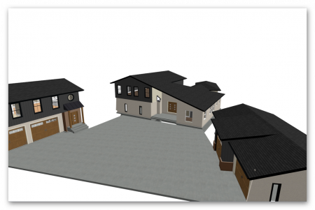
See if that is heading in the right direction, its working with auto roofs also do your signature I do not know what version you are using i figured it to be version12
Plus i deleted a lot of stuff to get the file small enough i think the terrain was the main file size problem
-
2
-
1
-
-
Can you share your plan
-
1
-
-
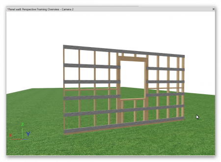
Have a look at this file, it has auto framing but you may need to manually draw batten below and above windows, the panel rebates are done with material regions draw one then multipul copy.
-
On 1/25/2026 at 4:57 PM, Frenchy1 said:
Are you an user? Not many of us. RAB made a video that included some stacked mouldings but it's still a bit you know fudgy trying to make it work
Typo
I think you are asking if I am a AU user yes my signature shows that also
-
Try this video the audio is a bit up and down but should help
If you still cannot do it send me your plan will have a go
-
They are a bit complex i have been trying to do video showing it as i spotted as a good topic for au users and getting stressed with it i need to relax and have another go when I am calm.
-
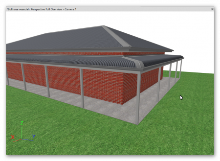
Hips and ridge capping
-
1
-
-
1 minute ago, Frenchy1 said:
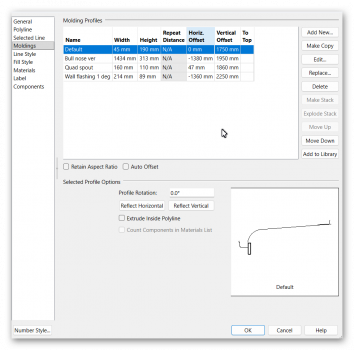
Also 2100mm in width
You just need to redraw the section line I used for the roof section of the molding polyline to get the 2100 width and adjust its position on the molding polyline.
let me know if it's to tricky
-
-
6 hours ago, AnkhRea said:
Hello,
I am new in this software. I made a leveled terrain (2% slope). I have separated parts on my terrain. For the large part, the house, everything is ok, the floor is on the terrain. But when drawing the walls of the second part of the property which is on the lower terrain, my walls are floating in the sky, approximately 20cm because the 0 level is on the main house. How can I create a new 0 level for the second part of the estate?
Thank you
I think you just need to put -20cm in the room floor height of the small gardern house
If that does not make sence upload your plan
-
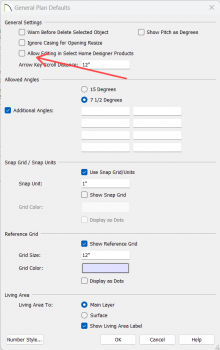
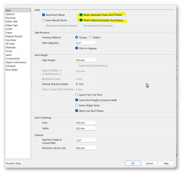
I know you have it done but would these setting been of use
-
Maybe share your Chief plan file then it will be easier to see what is going on
-
Stairs cut walls like roof so my guess is the that the stairs need to be pull to inside of wall.
-
1
-


Material Help - Complicated Tile Pattern
in General Q & A
Posted · Edited by Mark3D
One more thing i had ago at making it my self as a learning go at it, so it may not be perfect but it may be good enough