

JillGold
-
Posts
3 -
Joined
-
Last visited
Content Type
Profiles
Forums
Gallery
Posts posted by JillGold
-
-
1 hour ago, Chopsaw said:
So you are trying to duplicate the red dashed line in the section view ? Just draw your average terrain section line and copy it up the 30' and change the line style should work.
If it was really complex you could actually convert your terrain to a symbol and move it up 30'.
Hi, thanks for the response
")
Ah, awesome! I was able to convert the terrain to a symbol by selecting the terrain then going to Tools> Symbol> Convert to Symbol.
Now to figure out how to "cut" the symbol so that it only includes the area within my setbacks...
-
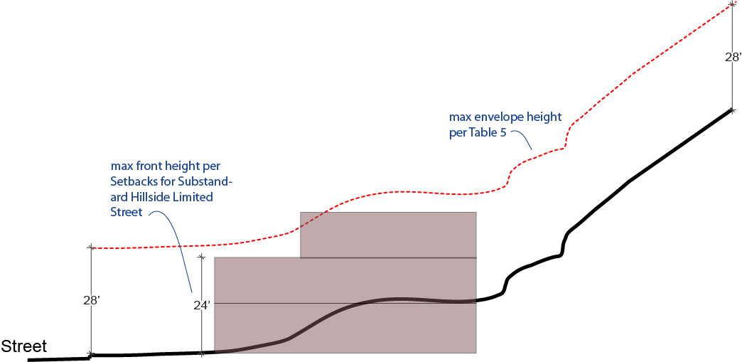
I live in Los Angeles, and building regulations in my area stipulate that the height of a house needs to be contained within a "maximum height envelope". The idea is that you drag the terrain plane up about 30' or so, to create a maximum height plane, and no part of the building can extend above that plane. Architecturals submitted to the City need to show this plane. (See Image example here)
There's a pretty straight-forward way to do this in AutoCAD. Does Chief Architect have a similar feature? If not, does anyone know of a work-around?
Chief Architect Premier X10
Build 20.3.0.54OSX
Running on Mac
Set a maximum building height using terrain plane?
in General Q & A
Posted
Thank you